One of the main parts of my Phd project is to collect the samples on which I am going to carry out the bulk of my experiments. Whilst so far I have been very lucky to have had samples to work on, donated to me by a number of colleagues, the time came when I needed some samples to call my own. I also felt that reading about my field area in journals was interesting, but, as many geologists will confirm, you need to visit your study area (field area) to fully take ownership of your research project.
So, in May 2011, Andy Biggin and I embarked on an adventure to sample some of the oldest rocks in South Africa. We traveled to Badplaas in the northeast of the country, which along with the larger Barberton (to the north), serves as the gateway to the Barberton Greenstone Belt. At our accommodation, we met up with Prof. Marteen de Wit (AEON), who has been working in the area for over 30 years, and, as you can imagine, has become quite an expert in the geology of the belt.
Prior to the trip, and as a result of work carried out by myself, but in most cases by others (Biggin et al 2011; Tarduno et al. 2007 & 2010; Usui et al. 2009; and Yoshihara & Hamano, 2004); Andy and I had identified areas that we wanted to target for sampling. The first order of business during the field work was to find places where we could reach the outcrop – which we would then drill. Palaeomagnetists can sometime be thought of as lazy when it comes to field work: in order to drill a locality we carry a large amount of equipment, so walking for kilometers to get to an outcrop is not really an option (unless the outcrop is truly unique!). Therefore, finding tracks to get to the outcrop became just as important as finding the outcrop itself. To that end, we spent the first few days, with Marteen as an excellent guide, hunting down the best spots for sample collecting.
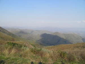
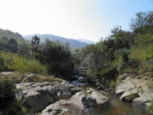
The reconnaissance was fun, exciting and sometimes a little challenging! I was the designated driver of our large 4×4, and not having driven off road prior to this trip, the first ford crossings, steep uphill climbs and U-turns in VERY small tracks were interesting to say the least. Nevertheless, we found some excellent localities to sample, surrounded by beautiful scenery.
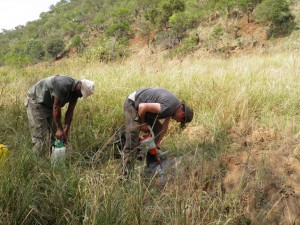
Next, I had to get to grips with our drill and learning how to orient the samples we collected. Geomagnetic samples are, for the most part, collected with a portable drill with a water cooled corer, which is diamond tipped. The drill is used to obtain a rock core which should be roughly 10cm long, although this varies depending who drills the core and how good they are at drilling (we discovered that Andy is far better at this job than I am).
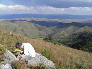
Before removing the core from the outcrop, its orientation within the outcrop must be accurately measured. This is done by slipping an orientation device (we used a sun compass and magnetic compass) over the core and measuring the inclination (dip) of the core axis and then using the sun and magnetic compasses for determining the azimuth of the core axis (Butler, 1992). Making detailed notes of the geology and field relationships in my field notebook was another of my main tasks on the trip.
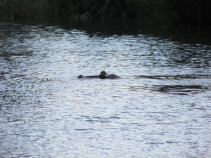
The trip was a success; we collected a large amount of samples, which now means I have a lot of work at the lab carrying out experiments. Working in South Africa was filled with amazing experiences such as: knowing that about 100m downstream of where we were working, there was a family of hippos; or encountering black rhinos at the end of a very long day; or knowing that I was sitting on some of the oldest rocks in the world!!! In truth, this post could have filled many, many pages, as there are so many anecdotes that I could tell about a long, but very productive trip.

Leave a Reply